University of Sydney
From 2011 – To 2012
Model and report submitted in 2012
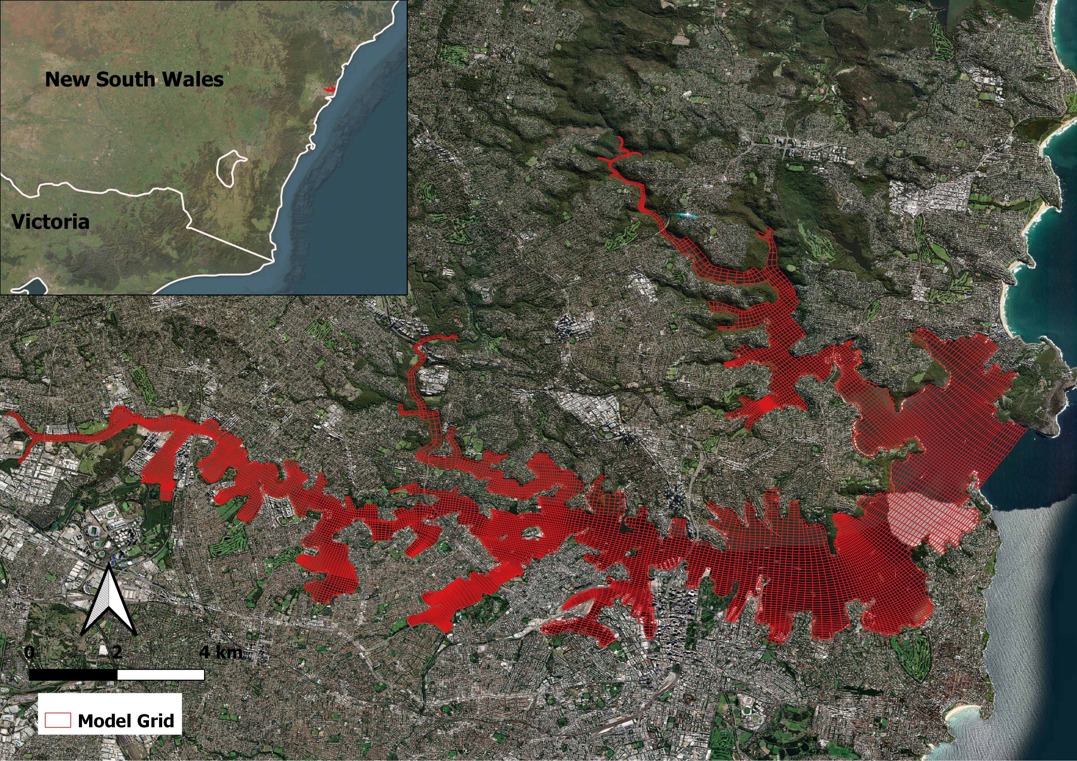
Sydney Harbour is located in a submerged valley estuary connected to the Tasman Sea in New South Wales, Australia. The estuary is approximately 30 km long, with a surface area of about 50 km², a catchment area of 589 km², and a complex topography and shoreline. Sydney Harbour is widely considered one of the world’s finest harbors and plays an important role in the history and development of Sydney as a commercial and recreational hub. It is also a marine nursery that hosts diverse marine habitats. As the strength and location of the East Australian Current varies as a result of climate change, there will be associated changes in the supply of land- and ocean-derived nutrients needed to support the biological population of Sydney Harbour.
DSI supported the University of Sydney in a two-phase project to develop the Sydney Harbour Observatory (SHO) to display real-time data for Sydney Harbour and its surrounding estuaries using the EFDC (Environmental Fluid Dynamics Code) hydro- dynamic model. The model collates observations from the Bureau of Meteorology (BoM), Macquarie University, the Sydney Ports Authority, and the Manly Hydraulics Laboratory offshore buoy. SHO also acts as a data management tool to centrally man- age and archive input from researchers; descriptions of this data are discoverable through the Research Data Australia web portal.

Real-time data from the BoM meteorological stations are automatically loaded into the EFDC model on two University of Sydney servers that run every 24 hours and provide output data to the client. Model output conforms to the industry standard of Climate Forecast (CF) conventions for NetCDF. Phase 1 of the project consisted of the development of the hydrodynamic and salinity model. In Phase 2, DSI added interfaces for inputting real-time environmental parameters such as humidity and temperature data into the SHED software program.
DSI submitted the final model and report to the client in 2012.