Confidential
DSI submitted the final model and report for use in management scenario analysis.
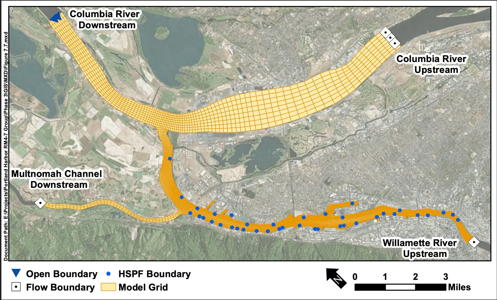
Portland Harbor, located along the lower Willamette River in Oregon, is an EPA-designated Superfund site. DSI has previously developed several numerical models of this region to support evaluations of toxic transport and sediment dynamics. In this project, DSI built upon the model validated with the latest ADCP data and tested the model under different client-specified design conditions.
The purpose of this project was to generate hydrodynamic model results to support the client’s 30% design phase for riverbank stabilization and physical stability analyses within the B1a project area. These modeled conditions and resulting outputs provide a comprehensive understanding of the forces exerted on the sediment bed, which are critical for the design and evaluation of proposed remediation and stabilization measures.
EFDC+ and EFDC Explorer (EE) were utilized to develop all testing scenarios and to perform post-processing of the model results. Since the client requested higher spatial resolution within the B1a area, a nested model with refined grid cells in the Willamette River was developed. The nested model maintained consistent hydrodynamic settings with the latest validated large-scale model to ensure continuity and accuracy.
To simulate the different conditions:
The final products included: