
Theun Hinboun Power Company, Vientiane, Lao PDR
2011, 2012, 2023
Model and report submitted in 2023
The Nam Gnouang (NG) Dam, Bolikhamxai Province, Laos, is built on a major tributary of the Nam Theun/Kading river system; it is located approximately 27 km upstream of the first Theun-Hinboun (TH) Diversion Dam and 9 km upstream of the confluence. The reservoir behind the dam extends approximately 40 km upstream and covers 105 square km at full storage. The dam is operated by the Theun-Hinboun Power Company (THPC). DSI performed a hydraulic analysis for possible failure of the NG Dam as part of the THPC’s Theun-Hinboun Expansion Project (THXP).
DSI, LLC has carried out this work on the dam failure hydraulic analysis of the NG Dam in support of THPC’s Emergency Action Plan (EAP) preparation. The EAP will facilitate the management of floods caused or exacerbated by the dam, whether as a result of dam operations or dam failure and to reduce the risk to lives and property as a consequence of dam failure.
Phase 1 of the study was a preliminary assessment for several NG Dam failure scenarios using the HEC-RAS model of the TH Reservoir. Based on the results of Phase 1, additional work was recommended for Phase 2 of the study, including further data collection and an extension of the HEC-RAS model to avoid the downstream boundary effect and properly represent the floodplain. Following the recommendations from Phase 1, the HEC-RAS model was revised and used for the analysis of the NG Dam failure scenarios.
The 2023 phase aimed to update and improve the 2012 model with the most accurate topographic data and the latest hydrological studies, and generate new flood maps from the model results. To further improve the study, the latest 2D version of the HEC-RAS was used in the study.
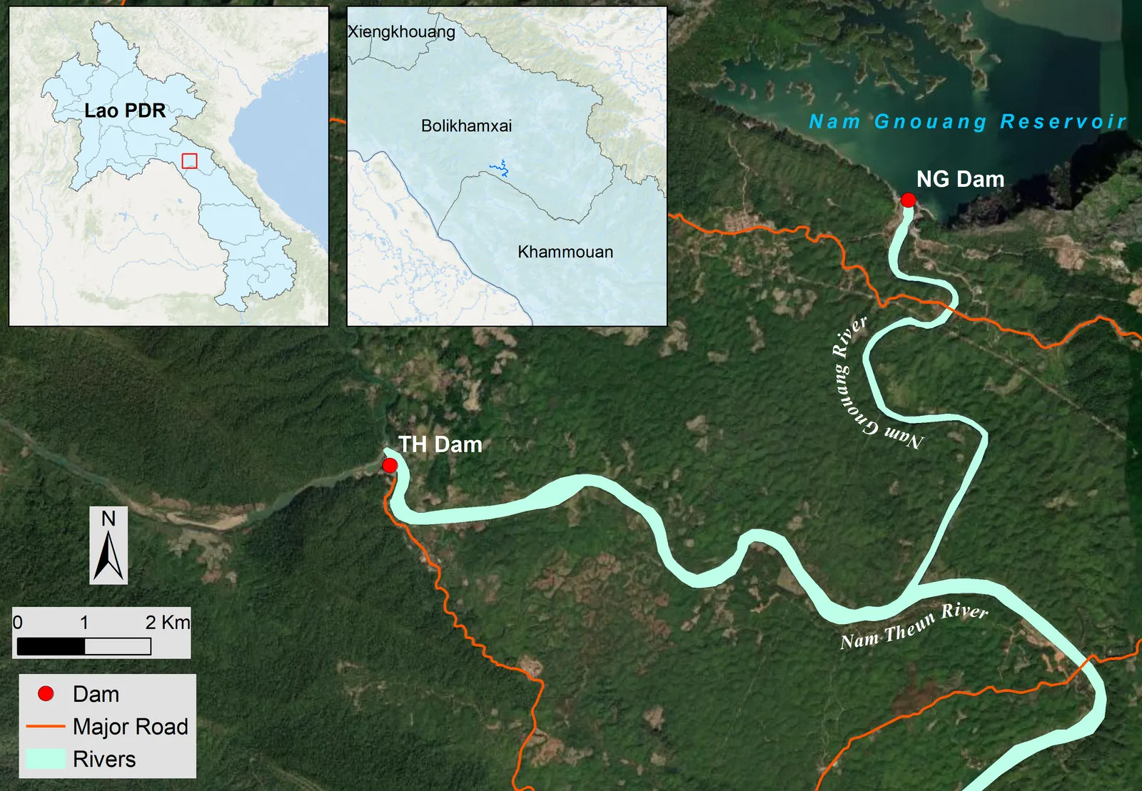 Nam Gnouang (NG) Dam in Bolikhamxai Province, Lao PDR
DSI conducted hydraulic analysis and developed inundation maps for a range of scenarios. Inundation levels and areal extents were needed to support the assess- ment, which followed USA Federal Emergency Management Agency (FEMA) dam failure guidance. Based on the results of the analysis, a series of flooding maps were prepared for the EAP.
DSI submitted the final model and report to the client in 2023.