Florida Department of Environmental Protection (FDEP)
From 2007 – To 2009
Model and report submitted in 2009
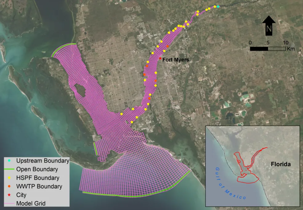
The Caloosahatchee River Basin, extending from Lake Okeechobee to San Carlos Bay on Florida’s west coast, is under the jurisdiction of the Florida Department of Environmental Protection (FDEP). Several of its Waterbody Identification units (WBIDs) are included in the State of Florida’s 2004 list of impaired water bodies because of nutrient enrichment and low levels of dissolved oxygen. The tidal estuary of the Caloosahatchee River is characterized by freshwater inflow from Lake Okeechobee along the non-tidal portion of the river that receives agricultural wastewater discharge and run-off from the urbanized areas around Ft Myers. The Caloosahatchee watershed, river and estuary extends approximately 1,400 square miles.
As part of FDEP’s Total Maximum Daily Load (TMDL) development process, DSI/Dynamic Solutions, LLC developed a linked HSPF watershed and Environmental Fluid Dynamics Code (EFDC) hydrodynamic/water quality model. A large database was developed from local, state, and federal sources integrated with ArcMap. Historic and baseline data, including land use, streams, tributary gauging, point sources, water quality, and meteorological data were used to develop the watershed loading model. The watershed model was then linked to the three-dimensional EFDC hydrodynamic, sediment transport, and water quality model of the river and estuary.
Submerged aquatic vegetation (SAV), such as sea grass, is seen by many as an indicator of the overall ecosystem health of coastal waters. EFDC+ Explorer was enhanced to post-process EFDC simulation results to characterize the attenuation of sunlight in the water column. As a result, the simulation can provide insight into the effectiveness of alternative water quality management options for improving water clarity to sustain or restore the establishment of SAV beds. A separate large-scale EFDC model was also developed to simulate the tidal and water quality inputs to the system from the Gulf of Mexico.
EFDC+ was used to model water quality, sediment oxygen demand, sediment diagenesis, and eutrophication kinetics in the Caloosahatchee Estuary. The linked models were used to simulate and compare historic and existing conditions and the effects of load reduction scenarios on water quality, sediment chemistry, and clarity in existing and potential seagrass habitat.
DSI submitted the final model and report to the client in 2009.